October 1, 2025
Tracking Icebergs & Ice Islands in the Canadian High Arctic
Posted by Adam Garbo
Introduction
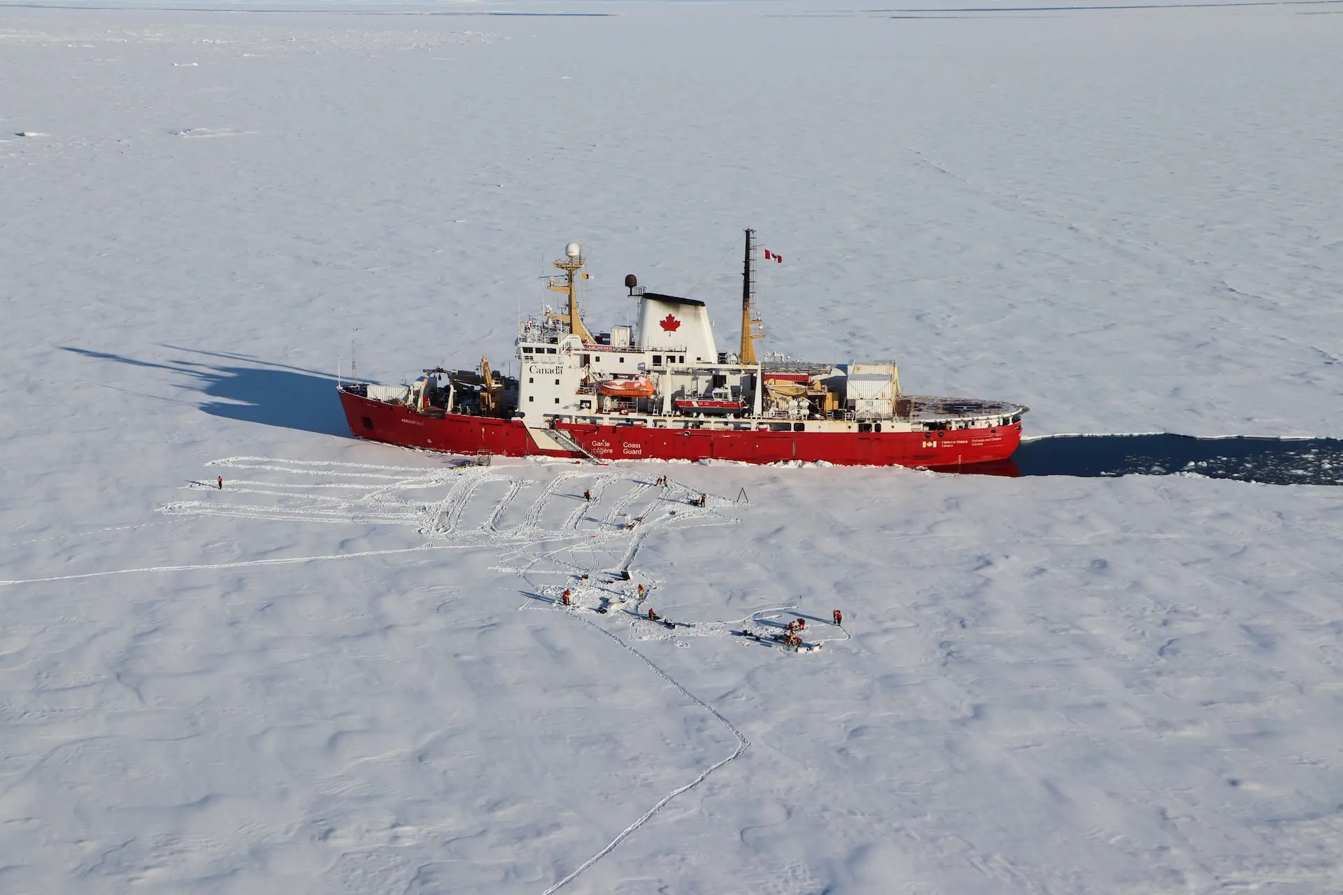
In September 2025, I returned to the Canadian Coast Guard research icebreaker CCGS Amundsen to continue tracking icebergs and ice islands using Cryologger Ice Tracking Beacons (ITBs) and to measure the thickness of glaciers as part of my doctoral research. The 2025 Amundsen Expedition, led by the University of Manitoba and Fisheries and Oceans Canada (DFO), provided critical support and funding for this work. Together with Erika Brummell, a Master’s student, we represented the Laboratory for Cryospheric Research at the University of Ottawa.
Having deployed Cryologgers across the eastern Arctic in previous seasons, from Baffin Bay to Nares Strait, this year’s mission marked a major milestone: the first time the Amundsen ventured into the Queen Elizabeth Islands. This enabled us to instrument icebergs drifting along the western coast of Ellesmere Island and within the Arctic Ocean, expanding Cryologger’s reach into one of the most remote and least studied regions of the Canadian Arctic Archipelago (CAA).
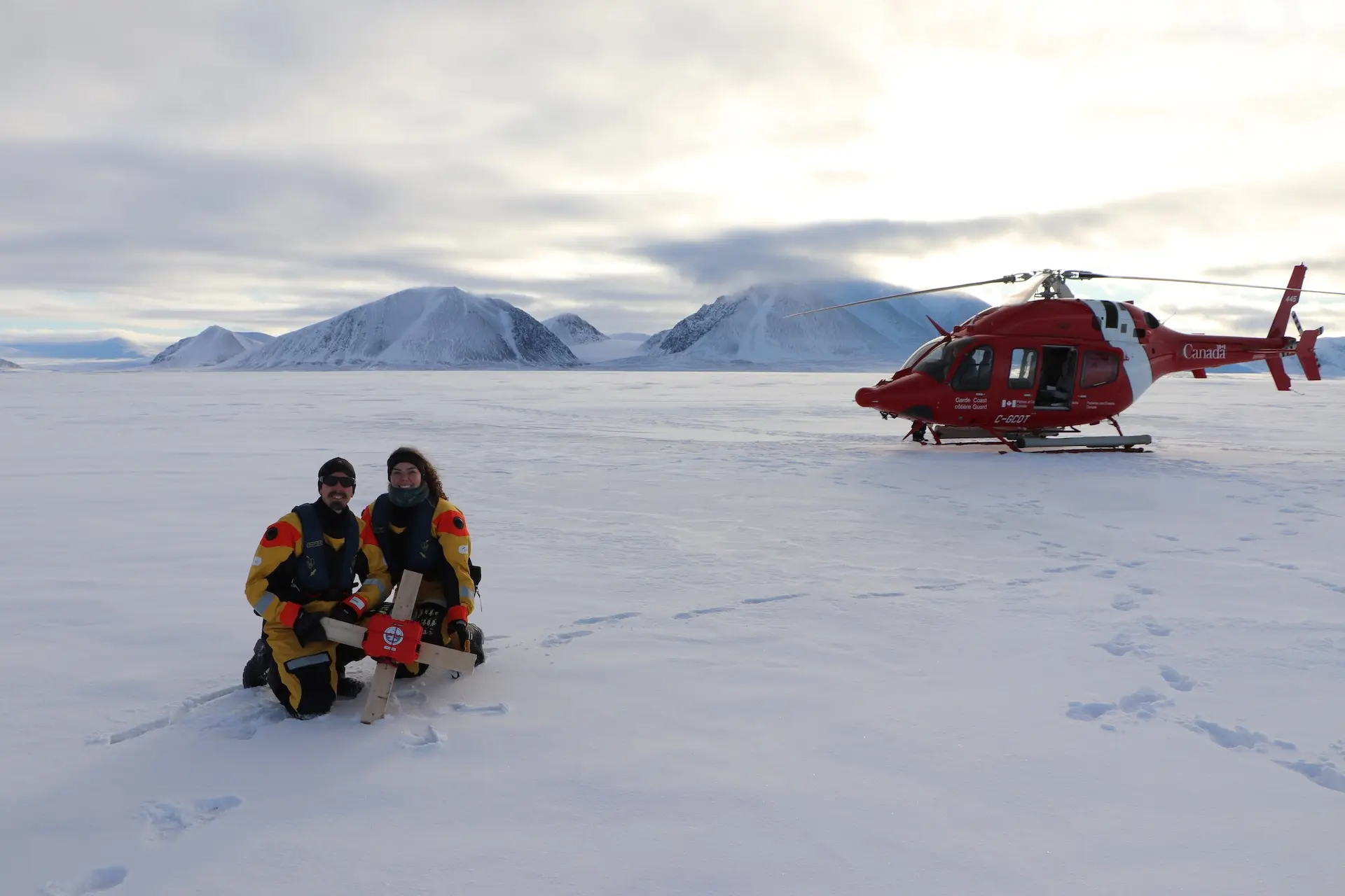
Adam Garbo and Erika Brummell deploying a Cryologger ITB from the Amundsen helicopter onto a drifting ice island.
What Happens in the Arctic Doesn't Stay in the Arctic
My PhD examines the lifecycle of Arctic icebergs, from the glaciers that form them to their calving, drift, and eventual melt. The 2025 deployments form an important part of that research, providing in-situ data from some of the most northerly ice islands ever instrumented.
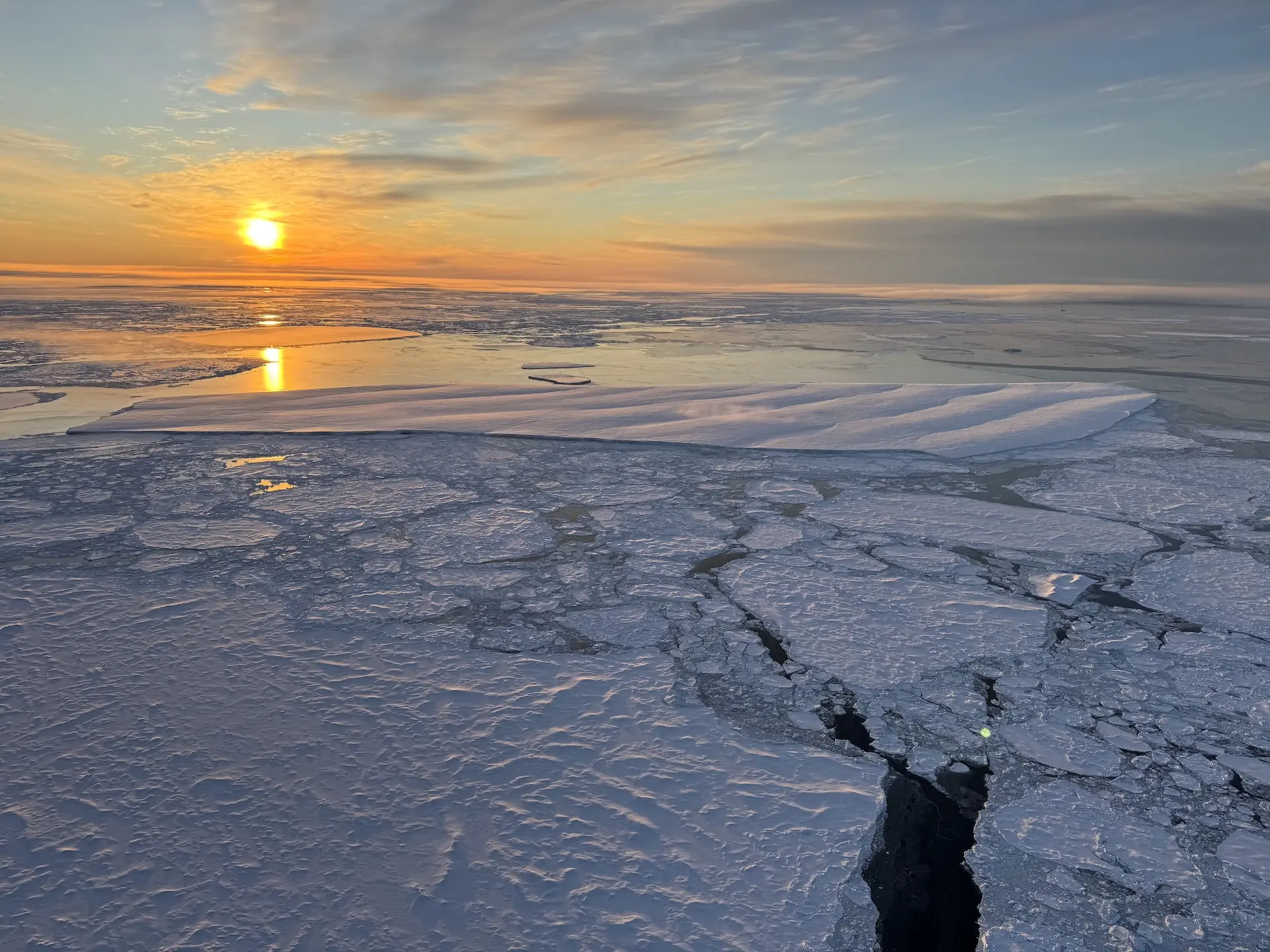
All deployments this year took place on fragments of the Milne Ice Shelf, which catastrophically disintegrated in 2020. These remnants, now scattered across the Canadian Arctic, represent the last vestiges of Canada’s once-continuous northern ice shelves. The icebergs we encountered varied greatly in scale: from smaller fragments a few hundred metres long to immense ice islands several kilometres across.
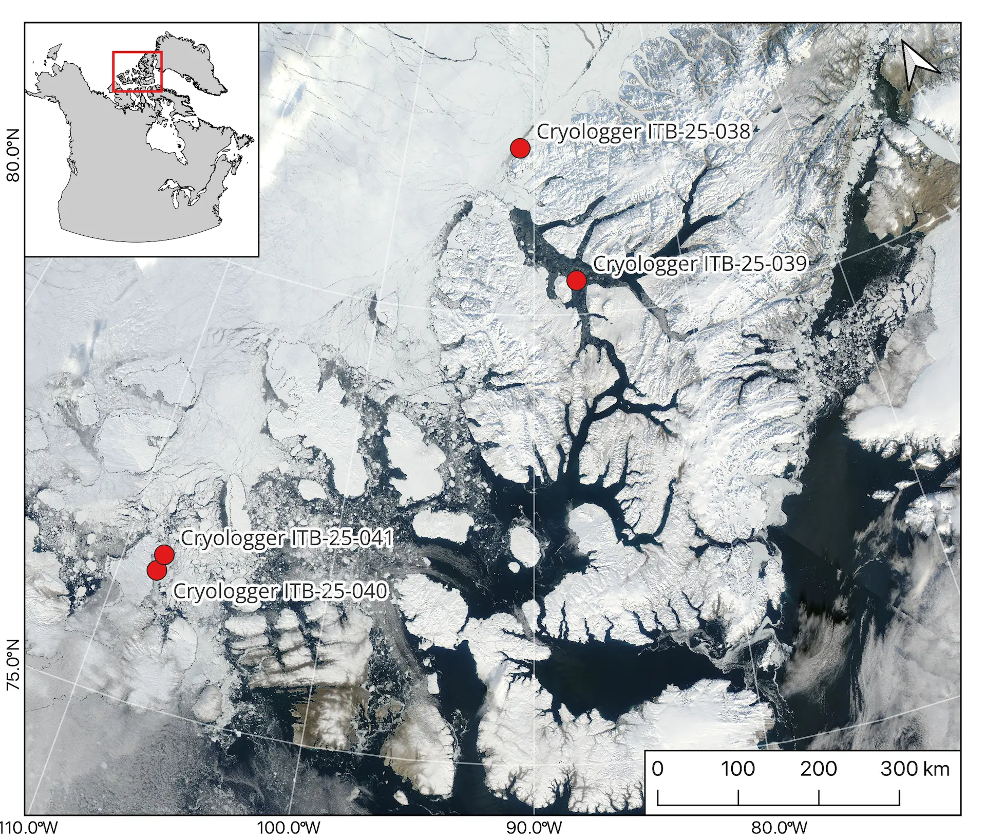
Cryologger ITB deployments made from the CCGS Amundsen during the 2025 field season.
We reached each iceberg by helicopter, landing directly on their surface to install Cryologger beacons. Where conditions allowed, we also measured ice thickness using a ice-penetrating radar system to better understand their internal structure and deterioration. Each site was documented with a photo survey before departure, capturing the remarkable diversity and complexity of these drifting ice masses.
Together, these measurements offer new insights into the behaviour and longevity of ice islands, particularly those derived from the Milne Ice Shelf, and how they continue to shape Arctic marine systems long after their parent ice shelves have vanished.
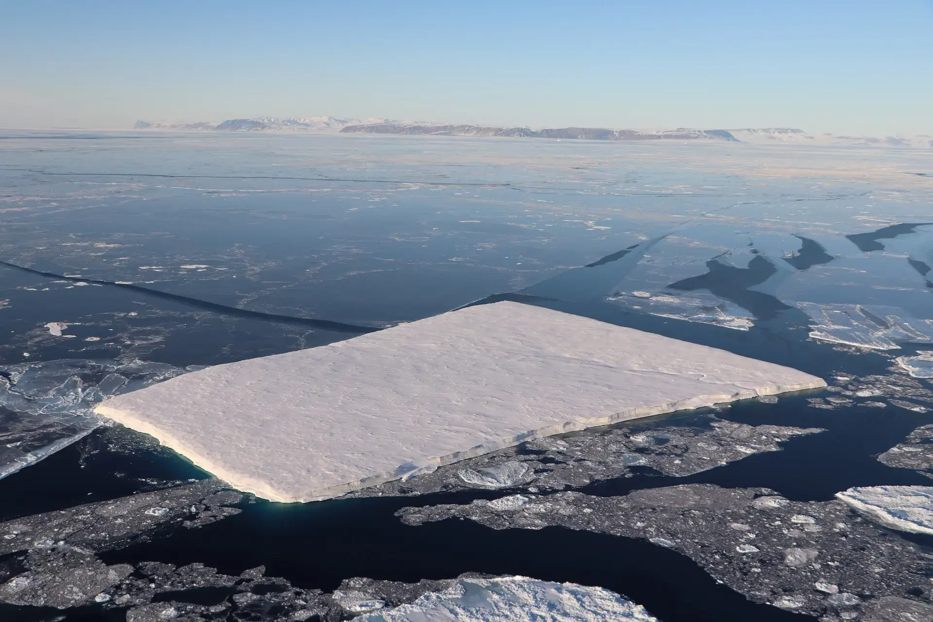
Milne Ice Island fragment along the coast of Ellesmere Island. Size approximately 4 square kilometres.
Why This Matters
The Arctic is changing faster than almost anywhere else on Earth. Ice islands and icebergs are a visible symbol of this transformation, breaking away from glaciers and ice shelves, drifting through complex ocean currents, and gradually melting into the sea. Tracking their movements is essential for understanding sea-level rise, ecosystem dynamics, and the hazards they pose to Arctic shipping.
Canadian Ice Service Perspective
Since the breakup of the Milne Ice Shelf on Northern Ellesmere Island in 2020, there has been increased interest in iceberg monitoring through shipping lanes in the Western Arctic and Canadian Arctic Archipelago. Ice islands in the Western Arctic will be in circulation and risk impacting navigation channels for the next century and will become a more serious risk with the opening of Arctic waterways due to climate change.
In-situ observations of ice islands collected by Cryologger tracking beacons will aide in the ongoing monitoring efforts of icebergs in the Western Arctic and CAA. These efforts strengthen Canada’s capacity to monitor and predict iceberg behaviour across the High Arctic.
Helicopter operations from the Amundsen make remote deployments possible.
Looking Ahead
These deployments underscore the growing role of Cryologger instruments in advancing cryospheric science. By combining affordability, reliability, and openness, the platform is enabling a global community of researchers to share data, replicate designs, and expand the scope of polar fieldwork.
For me, as a PhD student, these deployments represent both a scientific and personal achievement, connecting the calving of Arctic glaciers to the long journeys of icebergs throughout the Canadian Arctic. As these beacons continue transmitting through the coming year, their data will reveal how large ice islands evolve, drift, and ultimately disintegrate in one of the most rapidly changing environments on Earth.
Acknowledgements
I would like to thank the captain and crew of the CCGS Amundsen for their exceptional support and expertise throughout Leg 4. This work would not have been possible without their dedication. My gratitude also extends to the Chief Scientists and Amundsen Science for their continued commitment to advancing scientific research in the Queen Elizabeth Islands, and to Claude Dion, helicopter pilot, for his skill and assistance during the ice island deployments.
I would also like to acknowledge Abigail Dalton and Adrienne White of the Canadian Ice Service, as well as Alexandre Livernoche, our onboard Ice Services Specialist, whose expertise was invaluable for iceberg target identification and field operations.
This work was supported by the Natural Sciences and Engineering Research Council of Canada (NSERC), the Canada Foundation for Innovation (CFI), the Polar Continental Shelf Program (PCSP), the Northern Scientific Training Program (NSTP), the Canada Excellence Research Chairs (CERC) Program, and the Royal Canadian Geographical Society (RCGS).